


Tête de l'Aupet.

Dervalmarc
User
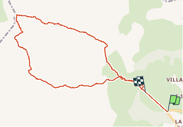

Length
11.9 km

Max alt
2610 m

Uphill gradient
1403 m
Km-Effort
30 km

Min alt
1213 m

Downhill gradient
1257 m
Boucle
No
Creation date :
2020-08-10 04:29:14.875
Updated on :
2020-08-10 11:21:15.613
3h49
Difficulty : Difficult

FREE GPS app for hiking
 SityTrail
IGN / Geographical institutes
SityTrail Plus
The world is yours!
About
Trail Walking of 11.9 km to be discovered at Provence-Alpes-Côte d'Azur, Hautes-Alpes, Le Dévoluy. This trail is proposed by Dervalmarc.
Description
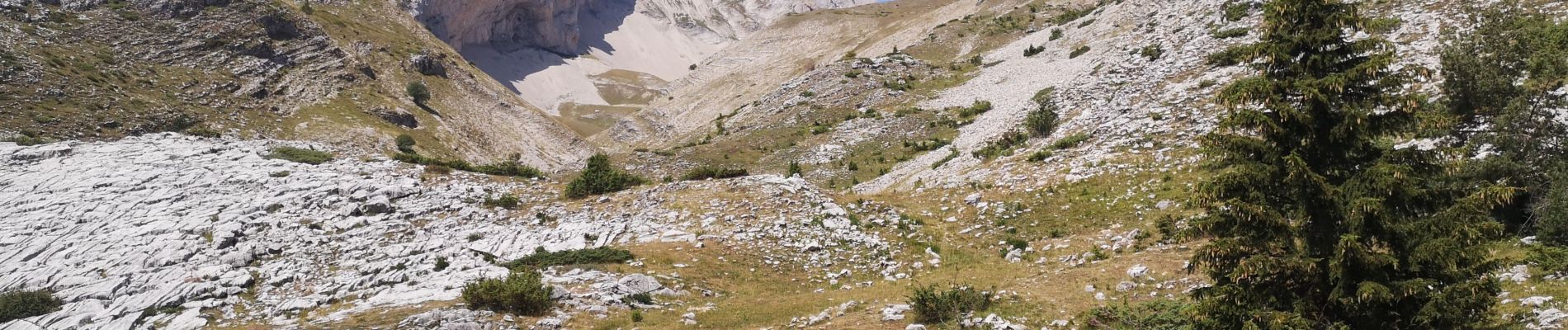
Longue randonnée. 17 km.
Passage aérien en crête.
Montée très raide dès le départ.
Photos


Positioning
Country:
France
Region :
Provence-Alpes-Côte d'Azur
Department/Province :
Hautes-Alpes
Municipality :
Le Dévoluy
Location:
Saint-Disdier
Start:(Dec)
Start:(UTM)
728140 ; 4955938 (31T) N.
Comments